A Beginner's Guide to Mining Claims in Colorado
The first time you find color in a Colorado stream — that first glint of gold catching sunlight in your pan — something changes. The mountains stop being scenery and start being geology. And sooner or later, you start asking the question every serious prospector eventually asks: Can I stake a claim here?
The answer, on most National Forest and BLM land in Colorado, is yes. The General Mining Law of 1872 gives American citizens the right to prospect and stake mining claims on federal public lands open to mineral entry. That law is still in effect. The process has a learning curve, but it’s navigable — and the investment is worth it when you find ground worth protecting.
Here’s what you need to know to get started.
Understanding the Types of Mining Claims
Not all claims are the same. Federal mining law defines several distinct claim types, each suited to a different type of mineral deposit. Getting this right from the start matters — the wrong claim type can leave you without the protections you need.
Lode Claims
A lode claim covers a hardrock mineral deposit — a vein, seam, or other linear deposit found in place within the host rock. If you’re following a quartz vein with visible gold or working a mineralized zone in bedrock, a lode claim is what you need.
Dimensions: A lode claim can be up to 1,500 feet long (along the vein) and 300 feet wide on each side of the centerline — a maximum of 600 feet total width. Most prospectors stake the maximum they’re entitled to.
What it covers: The deposit you’ve located, the surface above it for mining purposes, and the right to follow the vein on its dip to whatever depth it descends — even if it crosses the vertical plane of your surface boundaries. This “extralateral rights” doctrine is unique to lode claims and is one reason getting the claim staked correctly matters.
Placer Claims
A placer claim covers mineral deposits that occur in loose, unconsolidated material — alluvial gold in streambeds and gravel bars, mineral-bearing glacial deposits, and similar occurrences. If you’re finding gold in creek gravel, placer is your claim type.
Dimensions: Individual placer claims are limited to 20 acres. Associations of two or more persons can claim up to 160 acres total (8 claims). Placer claims must be rectangular and conform to the public land survey system (township and range) where possible.
What it covers: The surface material within the claim boundaries. Unlike lode claims, placer claims do not convey extralateral rights.
Millsite Claims
A millsite claim is not for mining — it’s for processing. A millsite covers non-mineral land associated with a lode or placer claim, used for a mill, processing facility, or other mining support operation. Maximum size is 5 acres per associated mining claim. Millsites are rarely relevant for beginning prospectors but become important for anyone scaling up operations.
The BLM Filing Process
Mining claims on federal lands are recorded with two agencies: the Bureau of Land Management (BLM) at the federal level, and the county clerk at the local level. Both filings are required — miss one and your claim may not be valid.
Step 1: Locate Your Claim on Open Land
Before you stake anything, verify the land is open to mineral entry. BLM’s LR2000 database and GeoCommunicator mapping tools let you check whether a parcel is open, withdrawn, or already claimed.
Federal lands closed to mineral entry include: - National Parks and Monuments - Wilderness Areas (no new claims; existing valid claims may remain) - Some specially designated lands under specific withdrawal orders
National Forest land is generally open to mineral entry unless specifically withdrawn. BLM land varies by location.
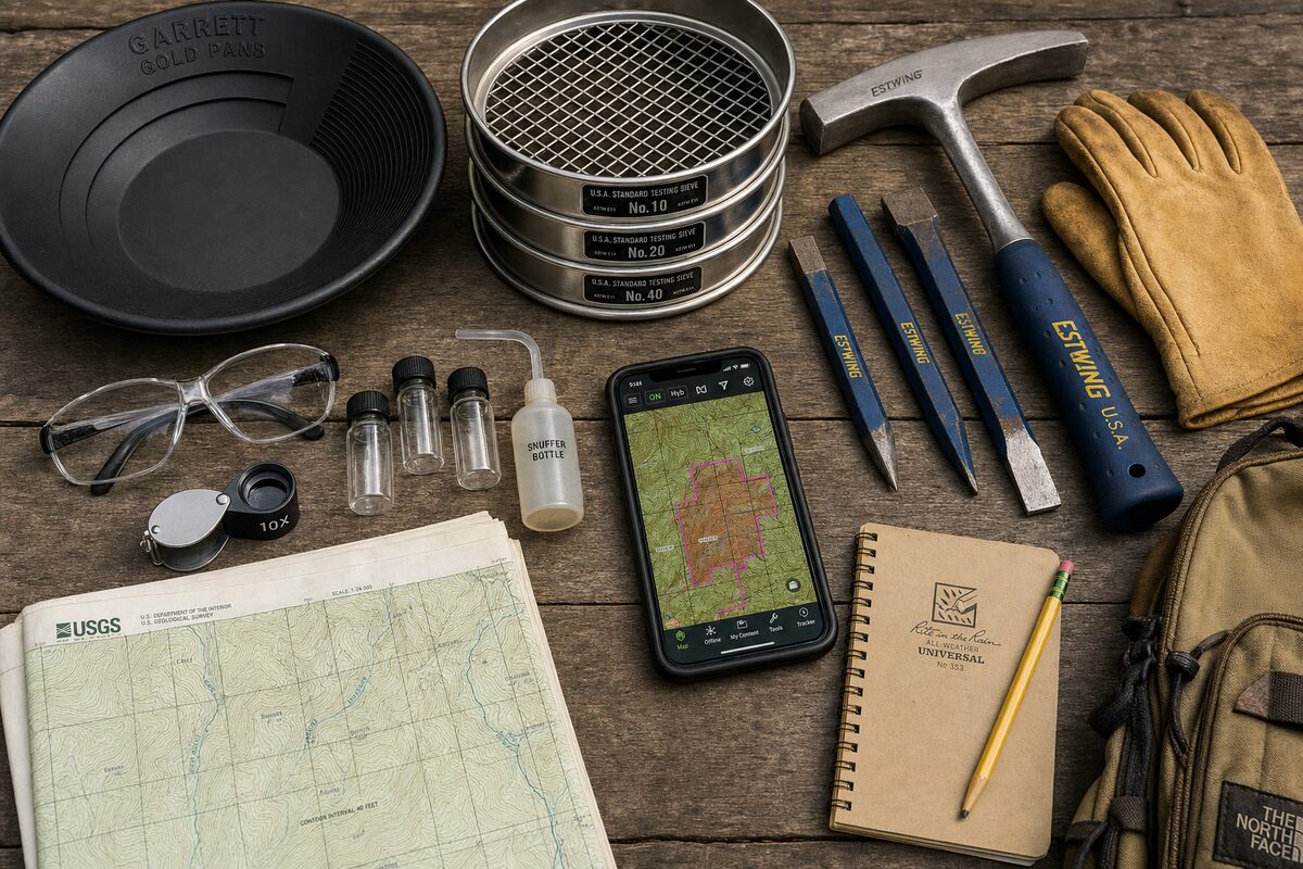
Step 2: Physically Mark Your Claim
Before filing any paperwork, the claim must be physically marked in the field. Requirements vary slightly by state and claim type, but the general federal standard calls for:
- Discovery monument at the point of discovery, marked with your name, date, and claim name
- Corner monuments at each corner of the claim area
- Side markers at appropriate intervals along the claim boundary
- Posted notice at the discovery monument including all claim details
For lode claims, the center line of the vein and the claim’s end lines must be clear. Use durable materials — metal posts, cairns with capped pipe, or equivalent markers. Stakes washed away by a spring flood are an expensive problem.
Step 3: File with the County Clerk
Within 90 days of staking, record your claim with the county clerk in the county where the claim is located. In Colorado, this means filing a notice of location or certificate of location, depending on claim type.
Filing fee: Typically $10–$40 per document, depending on the county. Some Colorado counties have seen this increase slightly in recent years.
The county filing establishes your priority date and creates a public record of the claim location and boundaries.
Step 4: File with the BLM
Within 90 days of the date of location, you must also file with the BLM state office. In Colorado, that’s the BLM Colorado State Office in Lakewood.
Required documents: - Notice of Location (copy of the county-filed document) - Map or sketch showing the claim location with reference to legal land description - Filing fee: $40 per claim (as of 2025; confirm current fee schedule)
The BLM assigns your claim a serial number and records it in the national LR2000 database. From this point, your claim is visible to anyone doing due diligence on the area.
Annual Maintenance: Keeping Your Claim Alive
A staked claim doesn’t last forever without attention. Federal law requires annual maintenance to keep a claim in good standing. This is where many beginners stumble.
The Assessment Year
The federal mining assessment year runs from September 1 to August 31. Annual maintenance must be completed before September 1 of each year to keep the claim valid for the following year.
Option 1: Assessment Work
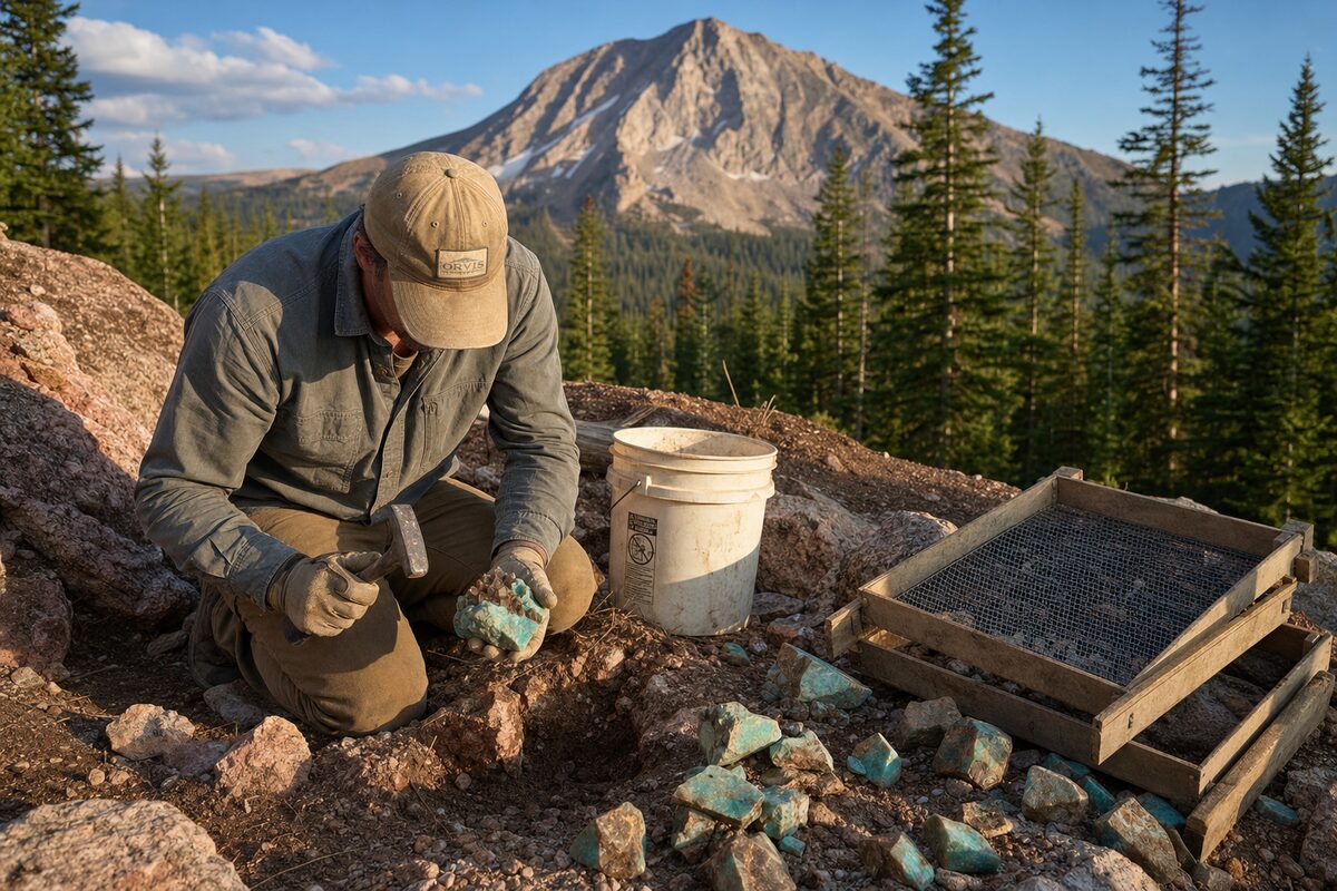
The traditional method of maintaining a claim is performing $100 worth of assessment work — physical labor or improvements on the claim — per claim per year. This can include:
- Excavation, trenching, or sampling work
- Road construction or maintenance for claim access
- Installation of equipment or structures for mining purposes
- Geological or geophysical surveys
Work must be documented with an affidavit of assessment work, filed with both the county clerk and the BLM.
Option 2: Maintenance Fee
Most claim holders today use the maintenance fee option, which replaced assessment work requirements under the Federal Land Policy and Management Act. The fee is currently $165 per claim per year, paid to the BLM before the September 1 deadline.
For most small operators with a handful of claims, the maintenance fee is simpler and more reliable than documenting assessment work. Pay it on time, every year, or the claim is automatically void.
Small Miner Waiver
Holders of 10 or fewer claims may qualify for a small miner waiver, which substitutes a $5 fee and a waiver application for the full maintenance fee. The catch: you must complete $100 worth of assessment work and file the required affidavit. For active prospectors doing regular fieldwork, this is worth exploring.
Colorado DRMS Requirements
Federal requirements govern the claim itself. Colorado’s Division of Reclamation, Mining and Safety (DRMS) governs what you can actually do on the ground in terms of surface disturbance.
Notice-Level Operations
For operations with limited surface disturbance — roughly less than a half-acre and no permanent structures — a Notice of Intent to Operate (NOI) filed with DRMS may be sufficient. This is the entry-level permit tier.
When a Notice is appropriate: - Small-scale hand mining or mechanized placer operations - Limited trenching or test excavations - Operations not requiring significant road construction or water diversions
Permit-Level Operations
Larger disturbances require a full DRMS permit, including a reclamation bond based on estimated reclamation costs. The bonding requirement is a real financial consideration for anyone planning serious mechanized mining.
DRMS is generally reasonable to work with — their field staff can often tell you what tier applies to your specific situation before you file anything. A phone call before breaking ground saves headaches later.
Common Beginner Mistakes
A few errors come up repeatedly among first-time claim stakers. Learn from them:
- Not checking for prior claims — Always search LR2000 before staking. Staking over an existing valid claim creates a legal mess.
- Missing the 90-day filing window — Both the county and BLM filings must happen within 90 days of location. Set a calendar reminder the day you stake.
- Inadequate physical monuments — A claim with missing or fallen markers is a vulnerable claim. Check your monuments each season.
- Letting maintenance lapse — One missed year voids a claim. Pay the maintenance fee before September 1, every year.
- Confusing open land — Not all federal land is open to mineral entry. Check before you hike.
Ready to Stake Your Ground?
The process sounds involved because it is — but it’s completely doable for anyone willing to do the homework. Thousands of active claims exist in Colorado today, held by individuals who went through exactly this process.
Explore our complete claims resource for county-by-county filing information, current fee schedules, and links to BLM and DRMS resources. And if you want to start by learning what’s been found in Colorado’s most productive districts, the prospecting guide is your first stop.
The ground is open. The law is on your side. Go find something.